Maui no ka oi (is the best) for waterfall hikes, challenging desert walks at Haleakala crater, lush jungle hikes at Hana, or strolls through uneven and dry lava flows along Makena’s La Perouse Bay coastline.
Maui is also easily accessible from the other Hawaiian Islands (via a local airport) and small enough to explore in a few days.
Here’s a rundown of all the hiking areas on Maui, waiting for you to explore.
HALEAKALA NATIONAL PARK
Hiking trail: Difficult
Undoubtedly the best hiking on Maui is at Haleakala Crater. If you’re in shape, do a day hike descending from the summit along Keoneheehee Trail (aka Sliding Sands Trail) to the crater floor. Try to pick a cloudy day, it gets hot walking across the moonlike landscape for hours under the midday sun. And bring lots of water!
You might also consider spending several days here amid the cinder cones, lava flows, and all that loud silence. Entering the crater is like landing on a different planet. In the early 1960s, NASA actually brought moon-suited astronauts here to practice what it would be like to walk on the moon. Tent camping and cabins are available with permits. On the 30 miles of trails you can traverse black sand and wild lava formations, follow the trail of blooming ahinahina (silverswords), and take in tremendous views of big sky and burned-red cliffs.
The best time to go into the crater is in the summer months, when the conditions are generally more predictable. Be sure to bring layered clothing—and plenty of warm clothes if you’re staying overnight. It may be scorching hot during the day, but it gets mighty chilly after dark. Bring your own drinking water, as potable water is available only at the two visitor centers. Overnight visitors must get a permit at park headquarters before entering the crater.
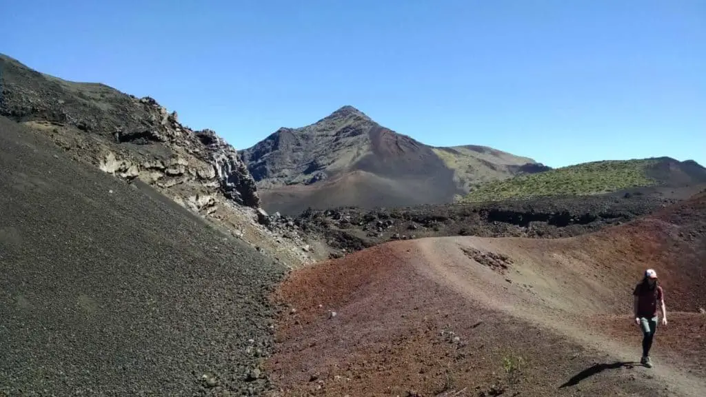
Trails in Haleakala, from shortest to longest:
Pa Ka’Oao
If you don’t feel like sharing the visitor center lookout with 400 other people at sunrise, take this five-minute trail to the top of White Hill for a little more breathing room (although you’ll be huffing on the walk up there). This 0.4-mile trail departs from the parking lot at the summit visitor center and offers views down into the crater floor below.
Leleiwi Overlook
This is the “secret” sunrise spot favored by locals and return visitors. Many assume that the best views will be from the top, but in some cases this just isn’t true. From Leleiwi Overlook, the view down into the crater is the same as from the summit—but it isn’t as far, and it isn’t as cold. Halfway between the park headquarters and the summit, pull off into the parking lot at mile marker 17.5 (about 8,800 feet in elevation) and follow a 0.5-mile trail through the subalpine brush. At first it won’t look like you’re going anywhere exciting, but after a few minutes you reach the rim of the crater and are awarded with colors which spring from the earth. This is a nice option if you are running late for the sunrise, and as an added bonus there are rarely more than a handful of people watching the spectacle with you. Since this lookout faces east, however, sunset isn’t as nice.
Hosmer’s Grove Nature Trail
Unlike other trails in the park, the Hosmer’s Grove Nature Trail is at the lower park boundary just after you enter the park. This easy, 0.5-mile trail leads you through a stand of trees introduced in 1910 to see if any would be good for commercial lumber. There are more than 20 different species here. Here you’ll see Jeffrey pine, ponderosa pine, incense cedar, eucalyptus, Norway spruce, Douglas fir, and Japanese sugi. Several signs are posted along the trail to explain about the trees, and this is also a good spot to look for native birds.
To reach the trailhead, make a left on the road pointing toward the campground immediately after entering the park. The walk should take a half hour over mostly level ground.
Ka Lu’u O Ka O’o
If you don’t have a full day (or couple of days) to devote to a hike across the crater floor, a nice option is the 5.5-mile descent to the Ka Lu’u O Ka O’o cinder cone. This hike departs from the Sliding Sands trailhead and drops two miles down into the crater, or about halfway down Sliding Sands trail.
Sliding Sands Trail (Keonehe’ehe’e Trail)
Starting at the summit visitors center (at 9,800 ft. in elevation) Sliding Sands descends 2,500 vertical feet to the crater floor below. Like a lonely vein switchbacking its way across the dark side of the moon, Sliding Sands is a barren, windswept, shadeless, and stunning conduit from the craggy summit to
the cinder cone desert before you. If you just hike down to the crater floor and back, it’s an eight-mile round-trip, although continuing to Kapalaoa Cabin tacks an additional 3.5 miles on to the hike. Due to the elevation, coming back up Sliding Sands can be challenging even for the fittest of hikers.
Switchback Trail (Halemau‘u Trail)
Beginning from an altitude of only 7,990 feet, the first 1.1 miles of this trail meander through subalpine scrub brush before eventually bringing you to the edge of a 1,000-foot cliff. The view down into the Ko‘olau Gap is better here than from the summit area. Although the trail is well-defined, the drop-offs can be disconcerting for those with a fear of heights. After losing over 1,000 feet in elevation, the trail passes Holua Cabin after 3.7 miles and continues on to silversword Loop, a section of the crater floor known for its dense concentration of ahinahina, or endangered silversword plants. While it’s possible to connect with the greater network of trails from this point, Silversword Loop usually marks the turnaround point for this 9.2-mile round-trip hike.
Sliding Sands Switchback Loop
If you’re in good hiking shape, have an entire day to commit, and want to experience the best of Haleakala Crater, then this is hands-down the best day hike in the summit area of the park. This is a point-to-point trail, so you will end up six miles from where you started — this means you need to drive two cars up the mountain or catch a lift back up to the parking lot.
While the loop can be hiked in either direction, the most popular—and far less strenuous—route begins at Sliding Sands trailhead and exits via ascending the Switchback Trail. Along the path of this 12.2 mile-journey you experience the full spectrum of Haleakala wonders, from the frosty, mystical summit, to the otherworldly solitude of the crater floor.
If you’re looking for an cool adventure and otherworldly experience, hike this trail at night under a full moon.
At this altitude you’re frequently above the clouds, and the moonlight reflecting off the cinder is so bright that you can walk without the use of a flashlight (bring one anyway). If the moon rises early, depart the summit at sunset, and if the moon rises later in the evening, begin at about midnight and finish your hike at sunrise. There are few more surreal feelings than walking completely alone, bundled against the chill of the night air, hearing the crunch of volcanic cinder beneath your feet, bathed in moonlight amid a panorama of geological wonder, only to cap off the experience by watching the
sun gradually set the colors of the mountain ablaze. Should you attempt to hike the crater by moonlight, it’s best to be overly prepared. Bring a backpack full of extra clothing, carry extra water, pack an extra flashlight. You’ll be exposed to windchills that can dip below freezing at any time of the year.
Kaupo Gap
“Shooting the gap” is the most extreme hike on the island. It takes two days, covers 17.5 miles, and has an elevation drop of 9,500 feet. In order to complete the hike you need to be in prime physical condition and comfortable in the backcountry.
The majority of hikers spend the night at Paliku Cabin, which at a distance of 9.2 miles from Sliding Sands trailhead is the remotest—and lushest—of the crater’s three backcountry cabins. For those without a cabin reservation there is a primitive campsite at Paliku; free permits can be arranged at the park headquarters.
On the second day of the hike you’ll make a steep descent from Paliku, pass through a gate that marks the park boundary, and continue across private land (which is allowed) from here until Kaupo Store. Once outside of the park boundary, keep a lookout for axis deer and feral goats, as they will occasionally leap across the trail.
You finish the hike in the semi-deserted outpost of Kaupo at a distance of 53 road miles from where you started, so if you ever want to make it back to civilization, you either have to arrange a ride or convince the rare passerby to shuttle your sweaty, backcountry body all the way to the other side of the island. If you’re up for the challenge, however, pack accordingly, be prepared, let someone know where you’re going, and take lots of pictures. There aren’t many places in America as pristine as what you’ll find out here.
Haleakala Crater Rd., Makawao
www.nps.gov/hale
$30 park entrance fee per vehicle (good for 3 days).
OHEO GULCH
Easy
A branch of Haleakala National Park and accessible on the southeast side of Maui, Oheo Gulch is was a tourist trap started by a former owner of the Travaasa Hotel Hana. He started calling the area Seven Sacred Pools to attract tourists to the Hana region — and it worked. There are more than seven pools and none have any historically sacred status — other than that this is Maui and everything is sacred and wonderful, of course.
When to Visit Seven Sacred Pools
Beat the crowds and rush of buses that visit the pools, and aim to be at Oheo Gulch early-ish in the morning. A popular hike nearby is a vigorous start to the day, and rewards you with a view of a tall waterfall — so plan to do the more challenging Pipiwai Trail first. The trailhead is a short walk to the east from the parking lot and across the road. The trail can get muddy to aim to do it in dry season or at least wait a few days after a rain.
After earning your meal for the day, relax by the pools with a bunch of other tourists, or cool off in the freshwater reserves. (Be aware, however, that the park periodically closes the pools to swimming when the potential for flash flooding exists.)
Getting to the Gulch
You can find Oheo Gulch on Route 31, 10 miles past Hana town. To visit, you must pay the $25-per-car National Park fee, which is valid for three days and can be used at Haleakala’s summit as well. Remember to bring your own water.
Trails at Oheo Gulch
Kahakai Trail
There are short, easy walks at the Gulch for you to explore. One quarter-mile walk stretches between Kuloa Point and the Kipahulu campground. Walk it for the rugged shoreline views and an easier hike than Pipiwai.
Kuloa Point Trail
Another easy half-mile walk, this trail goes from the Kipahulu Visitor Center down to the pools of Oheo at Kuloa Point. On the trail you pass native trees and precontact Hawaiian sites. Bring your swimsuit and a towel if you’re planning a dip in the pools—but exercise extreme caution, as no lifeguards are on duty. Stick to the pools; don’t even think about swimming in the ocean. The park periodically closes the pools when the potential for flash flooding exists, so try to plan your visit outside of rainy season.
Pipiwai Trail (The Hana Highway Bamboo Trail)
This moderate 2-mile trek (4-mile roundtrip) upstream can be slippery but is worth it; it leads to the base of the 400-foot Waimoku Falls. Wear hiking sandals if you want to walk through water closer to the base of the falls (provided it is safe and not raining).
Following signs from the parking lot, head across the road and uphill into the forest. The trail borders a deep gorge and passes onto a boardwalk through a thick forest of giant bamboo. This 4-mile roundtrip trail through muddy and rocky (and often slippery) terrain takes around one and a half to three hours to fully enjoy.
Although this trail is never overly crowded, it is best done early in the morning before the tour buses arrive and before the air gets too hot. Be sure to bring your favorite herbal mosquito repellent.
More about hiking the Pipiwai Trail.
Hana Hwy., Hana. Near mile marker 42. $30 park entrance fee per vehicle (good for 3 days).
UPCOUNTRY MAUI HIKES
POLIPOLI SPRING STATE RECREATION AREA
For a hiking experience suitable for hikers of all experience levels, head to Upcountry Maui to the Kula Forest Reserve at Polipoli Spring State Recreation Area.
During the Great Depression the government began a program to reforest the mountain, and soon cedar, pine, cypress, and even redwood took hold. The area, at an elevation of 6,200 feet, feels more like Vermont than Hawaii. It’s cold and foggy, and often wet, but there’s something about the enormity of the trees, quiet mist, and mysterious caves that makes you feel you’ve discovered an unspoken secret.
To reach the forest, take Route 37 all the way out to the far end of Kula, then turn left at Route 377. After about a half mile, turn right at Waipoli Road. You’ll drive up switchbacks until the road worsens but is passable. Four-wheel-drive vehicles are strongly recommended, although standard cars have been known to make it. Exercise your best judgment according to weather conditions.
Note: Stay on the trails and wear brightly colored clothing, as hunters may be in the area. 😐
Again: Polipoli Spring is often closed following heavy storms due to fallen trees and other
damage. Before attempting any trail in the park, Check the Hawaii State Parks website prior to making the drive up there.
Boundary Trail
This 4-mile trail begins just past the Kula Forest Reserve boundary cattle guard on Polipoli Road and descends into the lower boundary southward, all the way to the ranger’s cabin at the interception of the Redwood and Plum trails. Combine them and you’ve got a decent 5-mile day hike. The trail crosses many scenic gulches, with an overhead of tall eucalyptus, pine, cedar, and plum trees. Catch a glimpse through the trees of wide views of Kula and Central Maui.
Trailhead: Polipoli Campground, Polipoli Rd., Kula
Redwood Trail
This colorful 1.7-mile hike winds through redwoods and conifers past the short Tie Trail down to the old ranger’s cabin. Although the views are limited, groves of trees and flowering bushes provide feast enough for the eyes. At the end of the trail is an old cabin site and three-way junction with the Plum Trail and the Boundary Trail. Wear bright clothing, stay on the trail, and be aware you may encounter hunters who are hunting off the trail.
Moderate difficulty.
Trailhead: Near Polipoli Campground, Polipoli Rd., Kula
www.dlnr.hawaii.gov/dsp/hiking/maui/redwood-trail
Upper Waiakoa Trail
Start this scenic albeit challenging and rugged trail at the Polipoli Access Road (look for trailhead signs) and proceed up Haleakala through mixed pine and past caves and thick shrubs. The path crosses the land of Kaonoulu to the land of Waiakoa, where it reaches its highest point (7,800 feet). Here you’ll find yourself in barren raw terrain with fantastic views. At this point, you can either turn around, or continue on to the 3-mile Waiakoa Loop for a 14-mile journey.
Other than a cave shelter, there’s no water or other facilities on these trails, so come prepared. Wear bright clothing, stay on the trail, and be aware you may encounter hunters who are hunting off the trail. Difficult trail.
Trailhead: Polipoli Access Rd., Kula
www.dlnr.hawaii.gov/recreation/nah/maui-trail-and-access-maps
IAO VALLEY STATE MONUMENT
In Hawaiian, Iao means “supreme cloud.” Piercing the clouds, the Iao Needle, a tall chunk of volcanic rock, stands as a monument to the long-ago lookout for Maui warriors. Today, there’s nothing warlike about the area: the valley is a peaceful land of lush tropical plants, clear pools and a running stream, and easy jungle strolls.
The valley is one of Maui’s great wonders. Access this mystical valley in the middle of an unexpected rain forest near Wailuku in West Maui. At 750 feet above sea level, the 10-mile valley holds the clouds as though to cover its history as the site of a famous battle to unite the Hawaiian Islands.
To get to Iao Valley State Monument, head to the western end of Route 32. The road dead-ends into the parking lot ($5 per car). The park is open daily 7 am–6 pm. Facilities are available, but there is no drinking water.
Iao Needle Lookout Trail & Ethnobotanical Loop
Easy trail. Anyone (including grandparents) can handle this short walk from the parking lot at Iao Valley State Monument. On your choice of two paved walkways, you can cross the Iao Stream and explore the jungle-like area. Ascend the stairs up to the Iao Needle for spectacular views of Central Maui. Be sure to stop at the lovely Kepaniwai Heritage Gardens, which commemorate the cultural contributions of various immigrant groups.
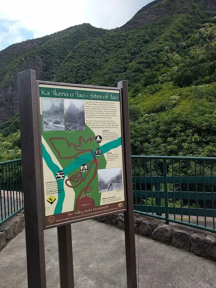
Trailhead: Iao Valley State Monument parking lot, Rte. 32, Wailuku
www.dlnr.hawaii.gov/dsp/parks/maui/iao-valley-state-monument
There is no fee to enter the valley but there is a $5 parking fee per car.
THE SOUTH SHORE AND WEST MAUI
In addition to the trails listed below, the Kapalua Resort offers free access to 100 miles of self-guided hikes. Trail information and maps are available at the Kapalua Adventure Center.
Hoapili Trail (King’s Trail)
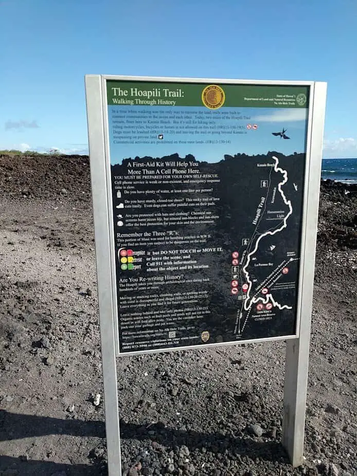
Difficult hiking trail. A challenging hike through eye-popping scenery in southwestern Maui is this 5 1⁄2-mile coastal trail beyond the Ahihi-Kinau Natural Area Reserve. Named after a bygone king, it follows the shoreline, threading through the remains of ancient villages. King Hoapili created an island-wide road, and this wide path of stacked lava rocks is a marvel to look at and walk on. (It’s not the easiest surface for the ankles and feet, so wear sturdy shoes.) This is brutal territory with little shade and no facilities, and extra water is a must. To get here, follow Makena Road to La Perouse Bay. The trail can be a challenge to find—walk south along the ocean through the kiawe trees, where you’ll encounter numerous wild goats (don’t worry—they’re gentle), and past a scenic little bay. The trail begins just around the corner to the left.
Trailhead: La Perouse Bay, Makena Rd., Makena
Kapalua Resort
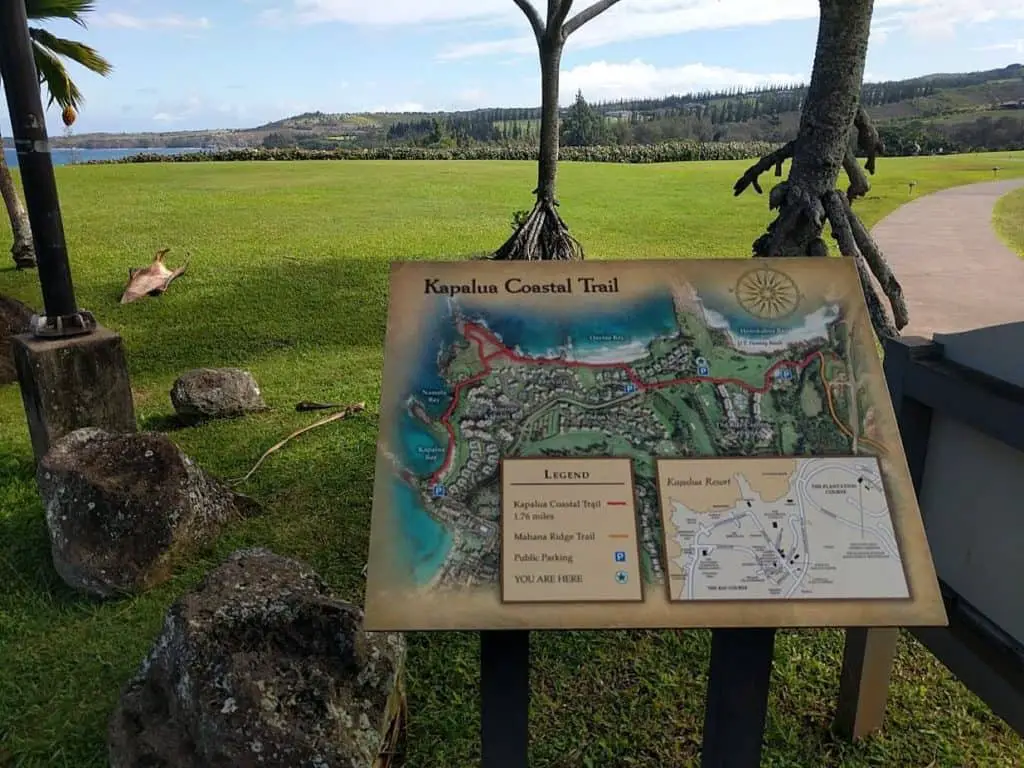
The Village Walking Trails offer a network of exercise opportunities on former golf cart paths, including the 3.6-mile Lake Loop, which features sweeping views and a secluded lake populated with quacking ducks.
The Coastal Trail provides views of the ocean and wildlife as it crosses the golden sand dunes of Oneloa Bay and past Ironwood Beach and the Ritz-Carlton, Kapalua, to its terminus at D.T. Fleming Beach Park. Sightings of green sea turtles, dolphins, and humpback whales (in season) are likely, along with nesting seabirds called uaua kani.
If you want the guided experience, guided 1 1⁄2 mile hikes on the coastal trail that include tide pool exploration are available for $99 through the Jean-Michel Cousteau Ambassadors of the Environment program at the Ritz-Carlton, Kapalua.
Makaluapuna Point (Dragon’s Teeth)
The fascinating series of lava formations at Makaluapuna Point in Kapalua is nicknamed Dragon’s Teeth. The forceful winds that sweep over the point caused the lava to harden upward into jagged
points resembling giant teeth. To get there, park in the small paved lot to the right at the end of Office Road, and follow the path at the edge of the Bay Golf Course (watch for errant golf balls, and be respectful of the golfers). Along the way, there’s a labyrinth where you can experience a meditative walk.
Wear sturdy shoes and bring water, as there are no facilities here.
Waihee Ridge
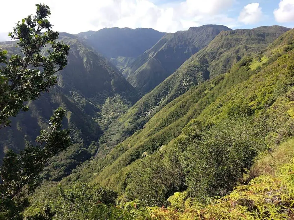
Moderate difficulty. This 4 3⁄4-mile hike in West Maui offers a generous reward at the top: breathtaking panoramic views of the windward coast and the ridges that rise inland, as well as Mt. Lanilili, Puu Kukui, Eke Crater, and the remote village of Kahakuloa. Enjoy a comfortable lunch at the picnic table. In rainy conditions the trail can quickly turn into a muddy slippery affair.
Getting there: from Highway 340, turn left across the highway from Mendes Ranch and drive three-quarters of a mile up a partially paved road to the signed trailhead.
Lahaina Pali Trail
The trail heads on either end are very rocky and steep on the first mile, but the view from the top is amazing. It may take about an hour to reach the windmill area (approx. 2 miles). This trail is recommended for people who hike regularly.
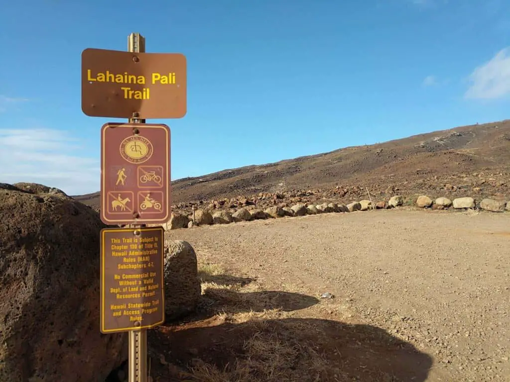
If you start from the east at Hanoapiilani Highway, I recommend turning back after the windmills. Be vigilant and remove items from view in your car; many people get their car broken into from the parking lot on the west side. Watch your footing on the trail, it’s pretty rough with small rocks.
Very good if you love a challenge. Start early in the day to take advantage of cooler weather. Sun protection and hats are a a must if you go after 10 a.m. Start early and bring lots of water, because there is no shade and it will get hot fast.
Hiking shoes or boots will keep you from hurting your feet and ankles while navigating through the loose lava rock.
MOLOKAI DAY TRIP HIKING
Kalaupapa Trail
You can take an overnight trip to the island of Molokai for a day of hiking down to Kalaupapa
Peninsula and back, by means of a 3-mile, 26-switchback trail. The trail is nearly vertical, criss-crossing the face of some of the highest sea cliffs in the world.
TIPS FOR DAY HIKES IN MAUI
Hiking is a perfect way to see Maui; just wear sturdy shoes to spare your ankles from a crash course in loose lava rock. At upper elevations the weather is guaranteed to be extreme—alternately chilly or blazing—so layers are good.
When hiking near streams or waterfalls, be cautious: flash floods can occur at any time. Don’t drink stream water or swim in streams if you have open cuts; bacteria and parasites are not the souvenir you want to take home with you.
If you’re new to hiking, here is a checklist for the basics to bring with you on a hike:
- Water (at least 2 quarts per person)
- Food—fruit, trail mix, and lunch
- Sturdy hiking shoes
- Layered clothing
- Rain gear or light poncho
- Sun protection: wide-brimmed hat and sunglasses and wool buff
- Natural mosquito repellent (near waterfalls and pools)



5 thoughts on “Maui: Best Hiking of all the Hawaii Islands”